Showing posts with label Bridge to nowhere. Show all posts

Top Ten Hiking Trails in Southern California

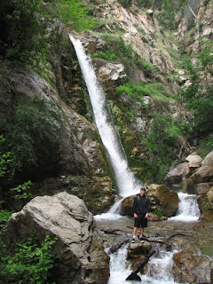
Big Falls, Forest Falls California

This is my list of my 10 favorite hikes in the Los Angeles/Orange County area. Most of these are less than a 90 minute drive from the heart of LA. Click on the text for more information.


Rose Valley Falls and Potrero John Falls


These hikes are a bit futher away, but within driving distance for a short 2 day weekend trip from the LA area. 
Avila Beach

This is a cool list of hikes on a great blog I found. This guy even has a list of his favorite breweries and a section just for waterfalls. I added the Devil's Punchbowl, Anza Borrego, and Cowles Mountain to my "to-do" list.
Share:

Bridge to Nowhere: Azusa California

Bridge to Nowhere, Azusa California


The Bridge to Nowhere is a mandatory Southern California hike that follows the east fork of the San Gabriel River to a lonely bridge that leads nowhere. The hike is relatively easy when the water levels are low, but it can quite treacherous in the spring.  When it’s running chest high, a lot of hikers give up at the first crossing.  The trail is approximately 9 miles round trip and parallels the river for the most of the distance until heading up the east bank for the last mile or so to the bridge.  To avoid getting lost, stay to the right on the river for most of the hike. My favorite time to hike to the bridge is in the late spring when the river is unruly and the crowds are thin. I usually end up dumping water out of my boots a half dozen times, but the solitude is worth it.  This hike is insanely popular in the summer.

In the summer, you can actually bungee jump from the bridge. Reservations can be made here

Trailhead:    From the 210 in Azusa, exit on Azusa Ave and head North towards the mountains. After about ten miles, turn right on East Fork Road and continue for 8 more miles to the East Fork Station.  East Fork Road turns into Camp Bonita Road which dead-ends at the parking lot.


Share:

West Fork Trail

Cogswell Dam Biking
West Fork Trail Waterfall
The West Fork Trail is actually a paved road that runs approximately 7 miles to a small campground. It’s a very easy hike with plenty of shade, bathrooms, and almost no elevation gain. I saw a ton of people pushing strollers and young kids riding razor scooters on memorial weekend. The trail runs parallel to a creek with a ton of fishing areas, swimming holes, and sandy beaches. There are several decent sized waterfalls along the trail on the tributaries that feed the creek. Several of the seasonal waterfalls along the upper part of the trail are fed by a natural spring and are probably potable. After passing the campground, the road climbs steeply out of the canyon for an additional mile to the Cogswell Dam. We had to walk our bikes up the last stretch of the road to get to the dam. There are several confusing “No Trespassing” signs at the top of the hill, but these refer to the private homes and not to the road itself. You can actually ride your bike across the dam, which was a pretty awesome and unexpected bonus. Although the road is open only to foot traffic and bikes, you will likely encounter the occasional construction or maintenance vehicle along the road. Bring plenty of water and snacks and make sure to have plenty of time to make it the dam and explore all the waterfalls along the way.

The trailhead is located about 14 miles north of the 210 freeway in Azusa on route 39.
Share:


Popular Posts

Labels Cloud