Showing posts with label Los Angeles Waterfalls. Show all posts

U.S. Forest Service closes Cucamonga Canyon


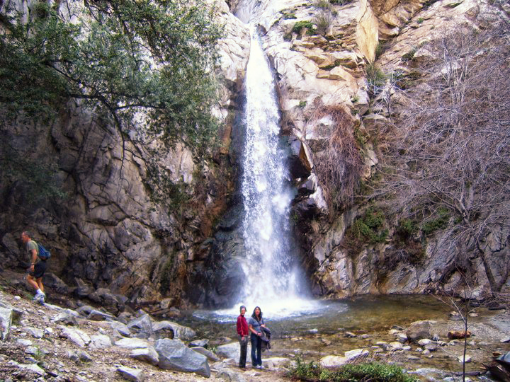
The Forest Service closed the Sapphire Falls Hike like I thought they would. The conditions in the canyon definitely warranted it. They're calling it "Fire Prevention", but if that were the whole truth, why wouldn't they close all of the trails in Riverside County and not just a 1,000 acres above Rancho Cucamonga? I'm 100 percent sure the decision has as much to do with the problems with graffiti, property damage, drug use, trespassing, public defecation, vandalism, accumulating trash and the large crowds creating an unsafe condition in the canyon. Someone from the Forest Service must have hiked in to Sapphire Falls on a weekend and seen it for themselves. I have no clue when they expect to open the canyon. Someone posted a comment to my blog that said the penalty for hiking into the canyon during the closure is $5,000. Ouch!

Share:

Sapphire Falls. The worst hike in Southern California

Sapphire Falls in Rancho Cucamonga
This hike is currently closed. 


 Last week I hiked to Sapphire Falls in Rancho Cucamonga with some friends. I can say without hesitation that it was the most filthy, polluted and completely despoiled trail that I have ever hiked. There were heaps of trash several feet tall strewn along the trail. The canyon walls were so completely covered in graffiti that it looked more like a freeway underpass than a nature hike. A local hillbilly was actually burning huge piles of discarded bottles and wrappers in a very misguided attempt to clean up and the canyon was completely filled with the putrid black smoke from the burning plastic. We actually got into a verbal altercation with him when we put out his trash fire.There were hundreds of people hiking in the canyon in the 90+ degree heat and many of the groups I saw only had a single bottle of water to share between several people. With such a large number of people jammed into such a small space, I highly suspect that the water in the creek is too dangerous to swim in because of fecal bacteria. If you accidentally swallow a mouthful of creek water, you might end up in the hospital. In case you have Sapphire Falls on your 'to do' list, let me strongly suggest that you save yourself some heartache and skip it. This easily gets my vote for the worst hike in Southern California. I've read rumors online that the city is trying to block access to the canyon and discourage hikers by issuing parking tickets. I almost never agree that closing a hike is an appropriate course of action, but in the case of Sapphire Falls, it might be the only option.
Share:

Escondido Falls, Malibu California


Escondido Falls


This is my favorite waterfall hike in the immediate LA area. On weekends, the trail can get extremely crowded because of its proximity to the city. I recommend hiking it during the middle of the week. The waterfall is just a trickle for most of the year, so try to hit it after a good rainstorm. 

"This hike takes you to one of the gems in the Santa Monica Mountains, the spectacular multi-tiered Escondido Falls. The hike starts out on the pavement, passing million dollar homes along Winding Way with lovely ocean views. After about a mile, an obvious trail takes you down into picturesque Escondido Canyon, crossing creek 4 or 5 times. As you approach the base of the lower falls, you can see the water dropping over the lip of the 150 ft upper falls in the distance. The lower falls are about 50 foot high and trickle over a moss covered wall into a lovely shallow pool. This is the turn around point for those not comfortable with a bit of rock scrambling.

To get to the upper falls, take the trail to the right of the lower falls up an obvious gully. At the top of the gully, go left and follow the stream over some small cascades and boulders to the base of the upper falls. This is an amazing site, with water tumbling over 3 or 4 tiers, finally falling into a deep
Share:

Solstice Canyon Waterfall and Ruins, Malibu California

Solstice Canyon Ruins

 Solstice Canyon is a fun, relatively easy hike to a small waterfall and the ruins of an old mansion in the mountains above Malibu. The hike can be completed in less than an hour. This is a popular hike for families because the elevation gain is moderate and gradual. Many hikers turn this hike into a loop by crossing the creek at the waterfall and returning to Solstice Canyon via the Sostomo and Rising Sun Trails.

The loop takes you up over a larger mountain and might be too difficult for
Share:

The Best Hikes in Los Angeles

The Best Hikes in LA

This is a Google map put together by ModernHiker.com of some of the best hikes in LA with detailed trail descriptions and directions to the trailheads. Click the picture of the map and it should open in a new window.

Here is a list of hikes on the map:
Sandstone Peak and Tri-Peaks
An easy hike for ‘intermediate beginners’ and novice hikers looking for a challenge. Great scenery, well-maintained trails, and lots of opportunities to branch out and explore. This is definitely one ...
Cucamonga Peak
A lengthy, steep hike up one of the tallest peaks in the San Gabriels. You’ll get a great workout, and amazing views off the peak’s nearly-sheer face — a small promontory that reveals the great L.A. S...
Timber Mountain
A long, tall hike down one of the most beautiful canyons in the Angeles National Forest. Probably the easiest way to reach Timber Mountain, the southernmost of the ‘Three Tees.’ Icehouse Saddle - just...
Dry Lake
A backpacking trip down a rarely-used route to a popular mid-mountain campground — an alpine lake-side camp in view of Southern California’s tallest mountains. A great way to get deep into the heart o...
Matilija Creek
A beautiful, isolated, and rugged river canyon in the Los Padres National Forest. Lots of river crossings, swimming holes, fascinating geology, and opportunities for off-trail adventuring. Read more...
Mount Lawlor
A short but rugged trip up to one of the lesser-known summits in the San Gabriels. Easily accessible, but still moderately challenging, with some light rock-scrambling and a use-trail descent if you’r...
Share:

Switzer Falls, La Canada Flintridge California

Lower Switzer Falls

Switzer Falls is one of my favorite hikes in the Los Angeles Area.  Most people just hike to the lower falls, but you can actually climb the lower falls and head upstream to the base of the upper falls which is among the best waterfalls in the Los Angeles area. The entire hike is around 7 miles round-trip to the upper falls, but it can feel tougher than that because the return trip is mostly uphill.


To reach the trailhead from the 210 in La Canada Flintridge, take the
Share:

Sturtevant Falls

Sturtevant Falls, Sierra Madre California

Sturtevant Falls is located a few miles North of Sierra Madre California in Big Santa Anita Canyon. The Canyon looks like something straight out of a storybook. It’s filled with cabins, oak trees, rambling brooks, stone walls and picturesque cabins.  If you’re lucky, or unlucky depending on how you look at it, you might even run into a black bear. If magic really exists in the world, you’re most likely to find it in this canyon.
The hike to the falls is approximately 4 miles round-trip from the parking area at Chantry Flats.  The trail to the falls is wide, well maintained and usually very busy.  Chantry Flats also serves as the starting point for the Mount Wilson trail, the Mount Zion trail, the Gabrielino Trail, Hermit Falls, Hoegees Camp, the Spruce Grove Camp and the Santa Anita Canyon Loop. Sturtevant Falls is one of the few waterfall hikes in Southern California where pets are permitted, so the trails here attract everyone from families to hardcore backpackers, but most of the casual hikers confine themselves to the Sturtevant Falls trail.

Share:

Blackstar Canyon Waterfall

Blackstar Canyon Falls


Blackstar Canyon is a secluded canyon located ten miles east from the heart of Orange. Blackstar has a reputation in Orange County for being haunted.  Every year around Halloween, Blackstar becomes a popular hiking destination for ghost hunters and local ghost tours.  Having recently hiked the canyon myself at night, I can honestly say that it’s definitely a spooky place.  I don’t actually believe in ghosts, but mountain lions and bobcats are known to inhabit the canyon. If the thought of a mountain lion pouncing on you from behind doesn’t spook you, I don’t know what will.

Blackstar Canyon has a hidden waterfall and a cave at the mouth of the creek.  From pictures, the falls look amazing when they are running, but they were bone-dry both times I visited. The hike to the waterfall is a little over 6 miles round-trip. The first two miles of the hike follow a wide dirt road that winds its way into canyon, crossing several bridges and never veering too far from the creek. The canyon is filled with willow, acorn, eucalyptus, oak, and a variety of other large trees. The trail cuts through several areas which are privately owned and fenced off with electric and barbed wire. You can spot the remnants of a dilapidated squatter’s camp just off the trail.

 At approximately 2 miles in, you will come to a
three- way junction. The main road veers away from the creek to the left and heads further into the mountains. The middle trail, a smaller single track hiking trail, follows the rim of the creek and gradually leads up into the mountains.  The right-hand trail descends to the creek bed and leads upstream to the waterfall and the cave.

Share:

Trail Canyon Falls, Sunland California

Trail Canyon Falls trail. Sunland, California

After several years of being closed, Trail Canyon Falls is finally open again.  With some nice weather in the forecast, I decided to drive up today and check it out.

 The last time I visited Trail Canyon Falls 2 years ago was a disaster. The trail had been neglected for several years after a large forest fire and was nearly impassable because of thick vegetation and flood damage.  We took several wrong turns, forcing us to walk upstream in the creek at a time when the water levels were unusually high and the currents truculent in the best of places. We never did make it to the falls, giving up when we were less than a half mile away. To top it off, we were attacked by a 4 foot long rattlesnake on the return to the car.

 I was pleasantly surprised this time around to see that the entire 3 mile trail had been completely repaired.   Even the parking area for the trail had been restored and widened.  

To get to the trailhead from Sunland, follow Big Tujunga Canyon Road North for approximately 4 miles to a small dirt road on the left side labeled on most maps as North Trail Canyon Road.  Turn left and follow North Trail Canyon Road for ¼ mile to the parking area.  

From the parking area you follow a wide gravel road through the locked car gate and up the hill, passing by a few sporadic cabins. There are 1 or 2 signs indicating the waterfall is ahead.  After a half mile or so, you will descend back down the creek and come to a small junction in the trail. The left hand junction dead ends after a hundred feet at some abandoned farm equipment and the ruins of a small cabin. Take the right hand junction and continue to follow the creek. The trail is wide, well maintained and quite obvious. You will have to make several small stream crossings. Another half mile in and the trail will cross to the left of the creek and you will gradually ascend to the top. This part of the trail is moderately strenuous, completely exposed to the sun, and probably inappropriate for small kids.  After gaining a 1,000 feet or so of elevation above the creek, you will round one last corner and the waterfall will come into view.  The waterfall is about 50 or 60 feet tall situated in the middle of the canyon. From the other descriptions I've read, it flows for most of the year, regardless of the rain. The climb down from the trail to the top of the falls is relatively easy. There are a few cool spots to take some pictures at the top of the falls. Getting to the bottom requires some effort and a willingness to get dirty. I put my hand on a tree branch to steady myself on the way down the cliff face and was promptly attacked by a swarm of biting red ants. The canyon floor was also overgrown in a few places with those stinging water nettle plants, so watch where you put your hands.


Share:

The Grotto Trail, Malibu

Pacific Coast Highway waterfalls, the Grotto Waterfall in Malibu, Malibu cave
The Grotto, Malibu

The Grotto, Malibu

The Grotto trail is a short, but fun 3 ½ mile round-trip hike to see a 20 foot waterfall that flows into a hidden cave.  The trail features a few other smaller waterfalls and a beautiful open meadow that is filled with wildflowers in the spring.  As you approach the waterfall on the grotto trail, the canyon narrows and the last ¼ mile of the trail can be a bit tricky. To reach the base of the falls and the hidden cave, you’ll have to navigate around, over, and through a maze of house-sized boulders. Grandma and your fat uncle Phil will have to wait at the top of the falls while everyone else does some exploring. You probably won’t be able to spend the entire day at the Grotto, but you might consider heading over to nearby Temescal Canyon in Santa Monica afterwards. 

To reach the Grotto trailhead from Pacific Coast Highway in Malibu, turn onto Yerba Buena Road and follow it 5 ½ miles to the Circle X Ranch Ranger Station.

For a more detailed description of the actual trail, visit http://socal.hiking.info/ventura/ve-grotto.php
Grotto Trail, Malibu California

The Grotto, Malibu California

Share:

Monrovia Canyon Falls

California Waterfall
Monrovia Canyon Falls
Monrovia Canyon Falls is definitely worth a visit. The hike to the falls is less than 2 miles round-trip and suitable for hikers of any ability. The falls are probably around 40 feet tall, but they’re fed by a spring so you can visit in the middle of summer and not be disappointed. I would definitely recommend doing Monrovia Canyon Falls during the week to avoid the large crowds and the LA “hikers”. I put "hikers" in quotation marks because I'm always a bit skeptical about anyone on the trail sporting a Raiders football Jersey, a teardrop tattoo, or a switchblade. The last time we made this hike, we had the place to ourselves and it was gloriously peaceful. Nothing ruins a hike faster than a gaggle of screaming teenagers drinking Coors Light and blasting Nickleback from a set of blown-out iPod speakers. You probably won’t be able to make a whole day of Monrovia Canyon, but you can easily see Monrovia Falls in the morning and then drive 5 miles west on the 210 and hit Hermit Falls and Sturtevant Falls in the little town of Sierra Madre. From the 210 Freeway in Monrovia, exit Myrtle Avenue, drive through Old Town Monrovia to Foothill Blvd, turn right, go two lights to Canyon Blvd, turn left, drive through residential area for about 1 mile staying to the right, turn right into Canyon Park at the 3-foot-tall sign. To avoid the $5.00 parking fee or to hike after hours, drive to the intersection of Canyon Drive and Ridgeside Drive (approximately 100 yards short of the Canyon Park three-foot tall monument sign). The park entrance is about half a mile from here. You can find parking just below this intersection along Canyon Drive. Pay careful attention to any ‘no parking signs’. Be aware that the curbside parking fills early on most weekend mornings.
Share:

Eaton Canyon Falls

Eaton Canyon Falls is a 40 foot waterfall located just outside Pasadena California. It was one of the first hikes I did when I moved to Southern California 2 years ago and definitely one of the most beautiful. The hike to the falls is less than 4 miles round-trip on a well maintained trail, so it’s perfectly suitable for novice hikers and kids. The waterfall is one of the best in the San Gabriel Mountains, and also one of the most heavily visited. On the weekends, you can pretty much guarantee that you’re going to have a lot of company on the trail. The falls are a very popular hangout spot for the local college kids, so you may have to tolerate whatever terrible music they’re blasting. I had to endure a 90 minute medley of Katy Perry and Lady GaGa. The trailhead starts at the Eaton Canyon Nature Center. The wide trail heads down into the canyon through the chaparral and brush to the creek. A fire road follows the creek wash upstream. Veer left onto the Eaton Canyon Trail and follow it until you come to a large concrete bridge. When you reach the bridge, head left again and follow the trail under the bridge and continue upstream. From this point, the canyon narrows and you will have to do some rock hopping over the creek. The trail ends at the base of the waterfall. There is a side trail that leads to the top of Eaton Falls, but it is extremely treacherous. There is a decent sized pool at the base of the falls. It’s just deep enough for swimming, if you can tolerate the icy cold water. From the 210, take the Sierra Madre Blvd / Altadena Drive exit and head north. The park’s entrance will be on your right in 1.7 miles.

Dont attempt to hike to the top of the waterfall unless you have a deathwish.
Share:


Popular Posts

Labels Cloud