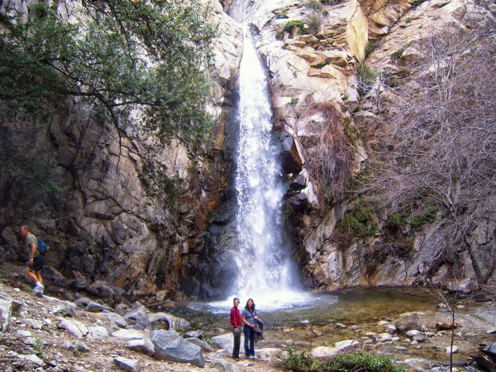
Showing posts with label Waterfalls in Southern California. Show all posts

Icebox Canyon, Red Rock Canyon National Conservation Area


Icebox Canyon Waterfall


Icebox Canyon is a fantastic intermediate hike in the Red Rock Conservation Area which is located just outside of Las Vegas Nevada. Icebox Canyon is about 2.5 miles round-trip from the parking area, but will probably take most hikers 2-3 hours to complete it at a normal pace. This trail can be a little sporting and requires some climbing and moderate uphill hiking on a rocky trail. Sprained ankles are a real concern on this one. If you have young children, if you're brand new to hiking, or if you're unsure you can handle the physical exertion, you may want to avoid this hike.

What to bring:

Red Rock Canyon is actually part of the Mojave Desert. Summer temperatures can reach 120+ degrees. Ideally, you want to hike this trail when the temperature outside is mild. I can not stress how important it is to bring at least a gallon of water per person if you plan on hiking this trail in the summer like a lunatic. Second, do not forget sunscreen. If you hike for 2 hours on clear day in Las Vegas, you will almost definitely end up with a serious sunburn . Third, sunglasses are a must. The Nevada sun will melt your eyes from your skull. Finally, let someone know where you're headed and what time you plan on returning. Protip: Remember to put your cellphone in airplane mode while you hike so your battery doesn't die searching for a signal. You won't get cell service in this part of Red Rock.

Red Rock Canyon National Conservation Area
The Trail:

 From the parking area, the dirt trail heads uphill and winds through thick shrubs which provide a little bit of shade. The trail splits about a quarter mile in, with one path leading up through the middle of the canyon in the dry creek bed, while the other section climbs above the creek bed hugging the right side of the canyon. I recommend keeping to the higher trail on the right. Both trails meet back together again after another half mile. Once you're inside the main part of the canyon, the final section of the trail requires some rock scrambling. You won't be able to get lost because the cliffs are hundreds of feet high on both sides of you. Just keep heading upstream through the dry creek bed until you reach the end. If you're lucky, you'll see a small trickling waterfall when you reach the end. Some people climb the waterfall to see the small pool at the middle of the falls, but the rocks are extremely smooth and slippery. Many people have been injured attempting the final climb. The pool at the top of the waterfall is too small to swim in anyway. All warnings aside, this is one of the best hikes in the Las Vegas area. There are very few places in the Mojave Desert where you can hike in the shade and see a waterfall.

Directions:

Red Rock Canyon is located about 20 minutes from the strip in Las Vegas. From Blue Diamond Road, turn right at Scenic Loop Drive. You will pay a 7$ entrance fee at the gate to get into the park. Ask for a map at the entrance. Follow Scenic Loop Drive for 8 miles until you reach the parking area for Icebox Canyon.

The address for Google maps is:
Ice Box Canyon, Las Vegas, NV 89161

Red Rock Canyon Trail Map

Share:

Los Penasquitos Canyon Waterfall

Los Penasquitos Canyon Trail

Los Penasquitos Canyon is a great day-use trail which is located about 20 miles north of San Diego. This trail is popular for hiking, biking and horseback riding. From the northern entrance located just off the 15 freeway, the Los Penasquitos trail follows the Penasquitos creek to a small cascading waterfall. From the northern trailhead, the hike is approximately 6 miles roundtrip to the waterfall. Most people can finish the hike in less than 3 hours.  The trail is almost entirely flat and is suitable for hikers of any age or ability. Dogs are also permitted on the trail as long as they are leashed.

The canyon is partly shaded by acorn trees, but there are some sections where you will be exposed to the sun. The summer temperatures in this area can be extremely hot, often in the 80-90 degree range.  Dehydration is a very real concern and hikers should be bring plenty of water for the trip. One small bottle of water will NOT be enough during the summer months.

Los Penasquitos Waterfall


For people who like to get away from the crowds, this trail may not be for you. Because of its proximity to the freeway and several large neighborhoods, this trail is almost always busy. The main trail through the canyon is extremely wide, but there are many smaller single-track trails which wind through the trees and provide some shade for hikers. Mountain bikers are not technically permitted to use the single-track trails, but many still use them anyway. Don’t be afraid to get off the main trail and do some exploring in the canyon. There are several fun wooden bridges which cross over the creek. You won’t be able to miss the waterfall because its marked by a giant rock outcropping in the center of the canyon. The waterfall is definitely the highlight of the trip, so don’t give up before you see it.  

Los Penasquitos Canyon


While not nearly as impressive as Cedar Creek Falls to the east, Los Penasquitos is unique because it is one of only a few waterfalls in the area which flows consistently.  Los Penasquitos Canyon is definitely worth a stop if you’re looking to get out of the city in San Diego and do a good a hike.

Directions to the Los Penasquitos Canyon trailhead:

From Route 15, take the Mercy Road exit and head west for approximately 1 mile to Black Mountain Road. The entrance to the trailhead is located at the intersection of Mercy Road and Black Mountain Road. There is a $5 fee to park at the trailhead, but there is free parking available in the adjacent neighborhoods if you don’t mind walking a bit further.  The trail is simple to find and starts at a locked gate at the far end of the parking lot.

Los Penasquitos Canyon Map


Share:

SkyPark at Santa's Village Grand Re-Opening 2016

Skypark at Santa's Village 2016

Opening Day is December 2, 2016

Situated high in the mountains above San Bernardino County in the tiny town of Skyforest California, there is a historic piece of Americana called Santa’s Village. Every year at Christmas time, parents and grandparents all over Southern California would make the annual trek up the mountain to take the kiddies to see Santa Claus. Originally opened in 1955, Santa’s Village was a beloved family Southern California attraction which operated for 30 years until finally closing their doors in 1998. In the years that followed, the park changed hands and fell into serious disrepair. In 2003, a wildfire nearly destroyed the remaining buildings on the property. Enter a new owner with a bold new vision for the park. After 30 month of painstaking renovations, Santa’s Village is finally scheduled to re-open this November just in time for Christmas.

Santa's Village 1991
For those of you who remember the park in it's heyday, Santa’s Village will look about the same as it did when it first opened all those years ago. Eighteen of the historic log cabins on the property have been fully restored to their former grandeur. The new owners really outdid themselves on the cabins. The small details are really first-class and rival anything you would see at Disney. With its snow-capped cabins, giant candy canes, glittering trees, elves, jugglers and even a real live white wolf, Santa’s Village really does feel like a winter wonderland.

The new Santa’s Village, dubbed “SkyPark at Santa’s Village", has expanded to include several mountain themed activities including a rock climbing wall, an outdoor skating rink, mountain biking trails, a skypedal monorail (whatever that it?), ziplining, hiking trails, electric assisted pedal cars and more. The outdoor skating rink is the first of its kind in the San Bernardino mountains since the Ice Castle in Blue Jay closed after a roof collapsed in 2001. The ice skating rink and rock climbing wall are nearly completed and should be ready in time for Christmas. The tentative plan for outdoor section of the park is to keep it open all year, but some of the attractions may not be ready until the spring of 2017.

Outdoor enthusiasts in Southern County will be excited to hear that the new owners of the park plan to add a camping area. For anyone who is unfamiliar with the tiny town of Skyforest where the park is located, Santa’s Village sits on a prime piece of land which is 6,000 feet above sea level and with spectacular views overlooking San Bernardino County below. The giant Lodgepole pine trees in the area are worth a visit themselves. When the new campground is opened in 2017, I’ll probably be the first one in line for a spot. 

Skypark at Santa's Village Map

If you want to turn a trip to Santa’s Village in a multi-day excursion, there are several awesome attractions and hikes nearby including Big Bear Lake, Lake Arrowhead, Snow Summit and Bear Mountain ski resorts, HeartRock Falls and Bonita Falls. For a real adventure, you could even pick up the Pacific Crest Trail at the northern end of Lake Arrowhead and hike 10 miles in to Deep Creek Hot Springs which is easily one of the best natural hot springs in Southern California.

For more information about the new Skypark at Santa’s Village, visit skyparksantasvillage.com

Skypark at Santa's Village is located on scenic Rim of the World Highway (California State Route 18) in the city of Skyforest

Share:

Angel Falls on Willow Creek. Oakhurst, California

Angel Falls near Oakhurst,California

Angel Falls is located about 7 miles from the town of Oakhurst California. If you’re headed to Yosemite from Orange County of Los Angeles, you’re most likely going to be driving through Oakhurst anyway, so Angel Falls is definitely worth a stop.  

Angel Falls is a series of cascades and small waterfalls along Willow Creek. The largest waterfall is probably around 20 feet tall. In the summer, these waterfalls are really popular among the locals. There are several great swimming holes and a few great places for cliff jumping if you’re brave enough, or dumb enough, depending on how you look at it. If you head upstream, there is a trail on the left side of the creek that leads uphill, but I prefer hiking through the creek. The granite has been polished over the years by the water, so be careful if you decide to try and climb up through the rocks. Wet granite can be as slick as ice and it would be easy to crack your skull if you slipped and fell.

I visited the falls in mid-June this year for the first time and the water in Willow Creek was cold, but not unbearable like some of the creeks and rivers in Yosemite.  Diving off the rocks into the crystal clear pools was one of the highlights of my Yosemite trip this year, and when you’re talking about Yosemite, that’s a real compliment. If you’re looking to budget your time on the way into Yosemite, I would say that 2 hours would be sufficient to explore the falls and take a swim. There is another larger 50 foot waterfall about a mile upstream from Angel Falls called Devil’s Slide Falls. I only found out about this "secret" waterfall by accident a few days later when I was browsing the internet in our hotel room. I definitely plan on coming back next year to see it. 

A word of warning: I’ve read that Angel falls can get really crowded on the weekends with kids partying.  It was basically empty on a Wednesday afternoon in June, so you may want to plan your trip accordingly. 

Direction to Angel Falls:
Drive North of Oakhurst on Highway 41 for approximately 3 miles. Turn right on Highway 222 (Bass Lake Road). Follow Bass Lake Road for approximately 3 miles and bear left onto Route 274. Continue for 1 mile and look for the dirt pullout on the left-hand side of the road just before the small bridge.  Parking can be difficult on weekends.

Share:

Hiking from Chantry Flats to Mount Wilson

Hiking to Mount Wilson with my trusty hiking pole and Granite Rocx backpack


Some general Advice about hiking the loops from Chantry Flats to Wilson:

There is a lot of confusing information online about hiking the loop from Chantry Flats to Mount Wilson. I’ll try to cover the basics in a single paragraph and give more details in the rest of the post. Including a stop at Cosmic Cafe on the top of Mount Wilson, this route is over 16 miles long and should be considered strenuous.  The Cosmic Cafe has extremely limited hours and is only open on weekends in the spring, so be sure to check the hours. You will also need a forest adventure pass or purchase a 5$ parking pass from Adam’s Pack Station at Chantry Flats. Don’t get locked in the parking lot, they close the gate at 8 pm. Make sure you have the appropriate gear for the hike. The temperature can fluctuate up to 50 degrees colder at the top of the mountain, so a jacket and gloves is definitely recommended. Bring plenty of water and a headlamp. Most of the loop is in a canyon and you don’t want to get stranded without a light if the sun goes down.  Make sure your boots are in good shape and wear a long pair of comfortable socks to avoid getting blisters.  Make sure you have a comfortable backpack. This is one of those long day hikes where a camel-back type backpack is too small for your extra gear and an overnight backpack is overkill.  This was my first hike with my new Granite Rocx daypack and it was a life saver.  I have shoulder problems when I hike with a heavy load on my shoulders, so I had to find an ultra-light backpack with a bunch of extra compartments for all of my gear.  This was seriously the first time I've hiked all year without any shoulder problems. 

Chantry Flats Loop to Mount Wilson:
Landmarks on the loop: Chantry Flats, Upper Falls Trail, Cascade Picnic Area,  Spruce Grove Campground, Sturtevant Trail, Mount Wilson Observatory, Cosmic Cafe, Mount Wilson Toll Road, Upper Winter Creek Trail, Chantry Flats.

The hike to Mount Wilson starts in the Chantry Flats parking area. From the parking lot, You head downhill on a winding paved road all the way to the canyon floor. Then head North on the Gabrielino Trail towards Sturtevant Falls. Make a left at the Fern Lodge Junction and continue North on the upper Falls trail,  or hike to the falls and then scale the incline on the left of the falls to reach the trail. This shortcut has eroded quite a bit in the last few years, so I don’t recommend it.  Continue North-West. You will pass the Cascade Picnic area, the Spruce Grove Camp and you will pass the spur trail that heads to Newcomb Pass.  You will eventually reach the junction for the Sturtevant Trail to Mount Wilson. This is the trail you want. Make a right onto the Sturtevant Trail and head up to reach the summit of Mount Wilson. From this junction, it’s approximately 3 ½ miles of endless switchbacks up the mountain. Once you reach the summit, you will see the Mount Wilson observatory telescope. From here, follow the paved road to the Cosmic Cafe. There is a large bathroom facility and a fill station for water bottles at the observatory.  To head back to Chantry Flats, the trail starts in the parking lot directly adjacent to the Cosmic Cafe. Its partially eroded and not obvious, even if you’re standing next to it. You hike down the steep trail until you reach the wider dirt road marked as The Mount Wilson Toll Road. This Road is no longer in service because of the landslides that block it. Head South on the road until you reach the junction for Upper Winter Creek Trail. Hike until you reach the trail junction for Hoegees Camp.  Do not hike to Hoegees Camp, stay right instead at the junction to remain on the Upper Winter Creek Trail. This trail heads slightly uphill for the first half mile, but will lead you around the mountain and downhill for the remainder of the trail right into Chantry Flats.  The loop is approximately 16 miles round-trip. It took us 8 hours to finish it, but we did stop for an hour at the top for lunch.

Notes on the trail:
I was not in shape for this hike. Not even close. I've only hiked once in the past 3 weeks, and this was a poor choice to get back into shape. The switchbacks absolutely murdered my legs and tender toes. Many websites incorrectly list the loop at 12 miles. In actuality, its over 16. The parking lot at Chantry Flats is insane on the weekends. People were parked on both sides of the road a mile away lining both sides of the road down the mountain.
The Spruce Grove Campground is the only place on the trail where we passed an outhouse. The campground was almost full, which is surprising for the start of April. The last 3.4 miles of the Sturtevant Trail to the observatory are a murderous, never-ending, unrelenting set of switchbacks and inclines. The trail spur to the Mount Wilson Toll Road at the Cosmic Cafe parking lot is damn near impossible to find. We had to ask another set of hikers to show us where it was. There is no way we would have found it on our own.  

Directions:
 From the 210 Freeway in Arcadia, take the Santa Anita exit North and follow Santa Anita Avenue for 1.5 miles to the yellow gate. Continue 3 miles up the narrow winding road to Chantry Flats parking area. It can easily fill up on the weekends, so expect to see cars parked along both sides of the road. Don’t forget your Forest Adventure parking pass.


Gabrielino Trail 

Sturtevant Falls


Share:

McWay Falls. Big Sur California

McWay Falls. Big Sur California 2012
McWay Falls is an 80 foot waterfall located an hour south of Carmel California on Pacific Coast Highway. McWay Falls plummets off a cliff onto a pristine beach. With the exception of Yosemite Falls, Mcway is the most photographed and arguably the most famous waterfall in California.  

The “hike” to the overlook is less than ¼ mile from the parking lot. The parking lot is almost always full, but it’s well worth the wait for a spot, so be patient.  Most people use the main lot and cross under Coastal Highway on foot through the tunnel.

Unfortunately, Mcway Cove is protected, so the falls can only be viewed from the overlook and not from the beach.  We saw several people ticketed by the park rangers for climbing down the hill to see the waterfall.  It’s a misdemeanor if they decide to prosecute you.


There are several other amazing waterfalls in Big Sur near McWay Falls.  Limekiln Falls, Salmon Creek Falls and Pfeiffer Falls are 4 of my favorite hikes in Big Sur, and all of the trailheads are located along coastal highway. Most of them are short  hikes, so you can map them out and see all 5 in one day. 

Share:

The Best of Yosemite National Park. (For the First Time Visitor)


Half Dome and Yosemite Valley as seen from Glacier Point 

Yosemite National Park is a a hiker's paradise, but the number of great hikes in the park makes planning a trip a daunting task. I literally spent weeks planning and researching my first trip to Yosemite National Park. I wanted to make sure that I didn't miss anything awesome. The end result was an amazing trip. Yosemite is probably my favorite National Park.  I've already done the work, so why should you? I'm posting the list of my favorite hikes in Yosemite so you won't have to. If you think I missed anything major, feel free to add it in the comment section.


1. Hike up the Mist Trail from Happy Isles to the top of Nevada Falls and come back down the John Muir Trail. If you have the time, the permit and the leg strength, you can hike all the way to Half Dome.

2. I would plan a day and do the short hikes around Yosemite Valley. My favorites are Bridalveil Falls, The Mariposa Grove of giant Redwood Trees, Lower Yosemite Falls, Mirror Lake and possibly a short raft trip on the Merced River from Curry Village.

3. I would highly recommend a drive up to Glacier Point. This is the best place in the park to view Yosemite Valley. You can pick up the Panorama Trail from Glacier Point and hike 2 miles downhill to Illouette Falls. This hidden waterfall is one of the best in the park. The return trip to the car is a leg burner.

4. Definitely consider driving east and exiting Yosemite through Tioga Pass. The crowds are sparse in this part of the park and the scenery  is definitely worth an little extra drive time. Lembert Dome is one of the best hikes in Yosemite. This part of the park features glacial lakes and green meadows around every turn. Mono Lake is located at the East entrance and features some of Southern California's best natural hot springs.

Attention: Tioga Pass and Glacier Point are usually only accessible in the summer months. 

Share:

U.S. Forest Service closes Cucamonga Canyon


The Forest Service closed the Sapphire Falls Hike like I thought they would. The conditions in the canyon definitely warranted it. They're calling it "Fire Prevention", but if that were the whole truth, why wouldn't they close all of the trails in Riverside County and not just a 1,000 acres above Rancho Cucamonga? I'm 100 percent sure the decision has as much to do with the problems with graffiti, property damage, drug use, trespassing, public defecation, vandalism, accumulating trash and the large crowds creating an unsafe condition in the canyon. Someone from the Forest Service must have hiked in to Sapphire Falls on a weekend and seen it for themselves. I have no clue when they expect to open the canyon. Someone posted a comment to my blog that said the penalty for hiking into the canyon during the closure is $5,000. Ouch!

Share:

Switzer Falls, La Canada Flintridge California

Lower Switzer Falls

Switzer Falls is one of my favorite hikes in the Los Angeles Area.  Most people just hike to the lower falls, but you can actually climb the lower falls and head upstream to the base of the upper falls which is among the best waterfalls in the Los Angeles area. The entire hike is around 7 miles round-trip to the upper falls, but it can feel tougher than that because the return trip is mostly uphill.


To reach the trailhead from the 210 in La Canada Flintridge, take the
Share:

Sturtevant Falls

Sturtevant Falls, Sierra Madre California

Sturtevant Falls is located a few miles North of Sierra Madre California in Big Santa Anita Canyon. The Canyon looks like something straight out of a storybook. It’s filled with cabins, oak trees, rambling brooks, stone walls and picturesque cabins.  If you’re lucky, or unlucky depending on how you look at it, you might even run into a black bear. If magic really exists in the world, you’re most likely to find it in this canyon.
The hike to the falls is approximately 4 miles round-trip from the parking area at Chantry Flats.  The trail to the falls is wide, well maintained and usually very busy.  Chantry Flats also serves as the starting point for the Mount Wilson trail, the Mount Zion trail, the Gabrielino Trail, Hermit Falls, Hoegees Camp, the Spruce Grove Camp and the Santa Anita Canyon Loop. Sturtevant Falls is one of the few waterfall hikes in Southern California where pets are permitted, so the trails here attract everyone from families to hardcore backpackers, but most of the casual hikers confine themselves to the Sturtevant Falls trail.

Share:

Blackstar Canyon Waterfall

Blackstar Canyon Falls


Blackstar Canyon is a secluded canyon located ten miles east from the heart of Orange. Blackstar has a reputation in Orange County for being haunted.  Every year around Halloween, Blackstar becomes a popular hiking destination for ghost hunters and local ghost tours.  Having recently hiked the canyon myself at night, I can honestly say that it’s definitely a spooky place.  I don’t actually believe in ghosts, but mountain lions and bobcats are known to inhabit the canyon. If the thought of a mountain lion pouncing on you from behind doesn’t spook you, I don’t know what will.

Blackstar Canyon has a hidden waterfall and a cave at the mouth of the creek.  From pictures, the falls look amazing when they are running, but they were bone-dry both times I visited. The hike to the waterfall is a little over 6 miles round-trip. The first two miles of the hike follow a wide dirt road that winds its way into canyon, crossing several bridges and never veering too far from the creek. The canyon is filled with willow, acorn, eucalyptus, oak, and a variety of other large trees. The trail cuts through several areas which are privately owned and fenced off with electric and barbed wire. You can spot the remnants of a dilapidated squatter’s camp just off the trail.

 At approximately 2 miles in, you will come to a
three- way junction. The main road veers away from the creek to the left and heads further into the mountains. The middle trail, a smaller single track hiking trail, follows the rim of the creek and gradually leads up into the mountains.  The right-hand trail descends to the creek bed and leads upstream to the waterfall and the cave.

Share:

Sequoia National Park

Great Western Divide, Sequoia National Park


Sequoia National Park is a HUGE park.  If you look at a map, it takes up more space than a few states on the east coast. Most of Sequoia National Park is uninhabited wilderness, accessible only by foot or horseback.  I could never hope to cover it in a blog post. There are entire books written about Sequoia that don’t cover everything there is to do. The purpose of this blog post is to cover the essentials for a 2-3 day camping trip for the first timer.

Sequoia National park is one of the best parks in the United States. I would easily rank it in the top 5 in the continental United States. (Yellowstone and Yosemite are my #1 and 2).  Sequoia National Park has caves, canyons, giant redwood trees, white water rafting, waterfalls, world class fishing, swimming holes, and endless opportunities for hiking and backcountry camping.

Most people visit Sequoia National Park in the summer.  The roadside campgrounds and the lodge fill up months in advance. The summer weekends can be absolutely hectic. If I were planning a trip for the first time, I would book for a weekday trip in September or early October when the weather is perfect and the crowds have thinned. Daytime temps for September range from 60-80, nights range about 20 degrees cooler. The park is located at mountain elevations, so it can get chilly at night. The chance for rain at this time of year is basically zero. The one and only disadvantage to visiting this time of year is that the water levels will be low, so the waterfalls will likely be less impressive.

The essential things to see in Sequoia National Park:

*Crystal Cave:  a 15$ ticket will get you a 45 minute tour of the cave. Its only open during the summer. Bring a jacket.

*Moro Rock: Moro Rock is a giant rock that overlooks the Great Western Divide. You hike a 400 step staircase carved into the face of the granite for the view of a lifetime. This is my favorite spot in the park. Once you reach the summit, climb under the railing and find some privacy on a secret lower tier that most people never see. Don’t fall off the edge or you’ll fall a few thousand feet straight down until you hit the valley floor.

*Tunnel Tree and Auto Log: These are both located along the road to Moro Rock. This is the spot where you see people driving through the giant fallen tree.

*General Sherman: This is the largest tree on earth. It’s well over 2,000 years old. The base of the tree is fenced off to keep tourists from trampling the dirt around the base of the tree. The root systems of these monster trees are surprisingly small.

*Buck Rock: A fire lookout set atop a granite peak at 8,500 feet, Buck Rock affords unobstructed views. about 5 miles off General's Highway. Southeast of Grant Grove, turn north onto Big Meadow Road, then turn left onto FS13S02 (that's a road number). Get to the lookout by climbing 172 metal steps suspended from the side of the rock. It's open to the public during summer. (source- about.com)

*Grant Grove: The General Grant Tree here is the world's third-largest, and is the nation's official Christmas tree. A 1/3-mile, wheelchair-accessible loop trail takes you past a settler's cabin and the Fallen Giant. (source- about.com)

*Topekah Falls: A perfect California waterfall that cascades a few hundred feet down a mountain face of granite and then plunges off  into a crystal clear swimming hole at the
base.

Share:

Trail Canyon Falls, Sunland California

Trail Canyon Falls trail. Sunland, California

After several years of being closed, Trail Canyon Falls is finally open again.  With some nice weather in the forecast, I decided to drive up today and check it out.

 The last time I visited Trail Canyon Falls 2 years ago was a disaster. The trail had been neglected for several years after a large forest fire and was nearly impassable because of thick vegetation and flood damage.  We took several wrong turns, forcing us to walk upstream in the creek at a time when the water levels were unusually high and the currents truculent in the best of places. We never did make it to the falls, giving up when we were less than a half mile away. To top it off, we were attacked by a 4 foot long rattlesnake on the return to the car.

 I was pleasantly surprised this time around to see that the entire 3 mile trail had been completely repaired.   Even the parking area for the trail had been restored and widened.  

To get to the trailhead from Sunland, follow Big Tujunga Canyon Road North for approximately 4 miles to a small dirt road on the left side labeled on most maps as North Trail Canyon Road.  Turn left and follow North Trail Canyon Road for ¼ mile to the parking area.  

From the parking area you follow a wide gravel road through the locked car gate and up the hill, passing by a few sporadic cabins. There are 1 or 2 signs indicating the waterfall is ahead.  After a half mile or so, you will descend back down the creek and come to a small junction in the trail. The left hand junction dead ends after a hundred feet at some abandoned farm equipment and the ruins of a small cabin. Take the right hand junction and continue to follow the creek. The trail is wide, well maintained and quite obvious. You will have to make several small stream crossings. Another half mile in and the trail will cross to the left of the creek and you will gradually ascend to the top. This part of the trail is moderately strenuous, completely exposed to the sun, and probably inappropriate for small kids.  After gaining a 1,000 feet or so of elevation above the creek, you will round one last corner and the waterfall will come into view.  The waterfall is about 50 or 60 feet tall situated in the middle of the canyon. From the other descriptions I've read, it flows for most of the year, regardless of the rain. The climb down from the trail to the top of the falls is relatively easy. There are a few cool spots to take some pictures at the top of the falls. Getting to the bottom requires some effort and a willingness to get dirty. I put my hand on a tree branch to steady myself on the way down the cliff face and was promptly attacked by a swarm of biting red ants. The canyon floor was also overgrown in a few places with those stinging water nettle plants, so watch where you put your hands.


Share:

100+ ft. Cliff Jump at Cedar Creek Falls

These guys were jumping from a spot about 20 feet below the top of Cedar Creek Falls in San Diego. The fall is at least a hundred feet, maybe more. As of October 2012, the falls are almost bone dry. The pool at the base is filled with algae. I wouldn't swim in it right now unless you want to end up with a bacterial infection.


Share:

Nobody Hikes in LA.

Swimming in Monrovia Falls

This is a HUGE list of hikes in the LA/Orange County area. Many of the links are clickable.

Abalone Cove

ABCD Loop – see Santiago Oaks Regional Park
Airport in the Sky – see Catalina Island
Airport Loop Trail – see Catalina Island
Alger Trail Camp – see Momyer Trail
Aliso Canyon Trail (San Fernando Valley) – see Porter Ranch Loop
Aliso Peak

Share:

Salmon Creek Falls, Big Sur California

Salmon Creek Falls, Big Sur
Salmon Creek Falls is the best waterfall on the Big Sur Coast.  McWay Falls would be a close second. If you’re planning a trip up the coast on Highway 1, it’s pretty much mandatory that you add it to your itinerary. The falls are over 120 feet tall and they flow consistently all year round, even during long periods of drought when most of the other falls have dried up. No other waterfall in Big Sur flows with a higher volume of water. In fact, you probably won’t find a mightier waterfall on the entire coast of Southern California. The hike from the highway to the base of falls takes less than ten minutes. Your morbidly obese grandmother probably won’t make it up the trail, but the it’s likely suitable for everyone else. If you’re an adventurer like me, you’re going to want to climb to the top of Salmon Creek Falls and explore the cave at the precipice. The trail from the base to the top is pretty perilous, but worth the effort in my opinion. You have to weave your way up the right side of the steep canyon, grasping at saplings, roots, poison ivy, and whatever else to keep from slipping on the loose gravel and mud. Once you reach the top of the falls, you can rock-hop across the river slip into the cave from a hidden opening on the back side. Only attempt this if the water level is low and he cave is dry. If you slip on the lip, it’ll be the last mistake you make. Salmon Creek falls is located on a hairpin turn 18 miles North of San Simeon California (Hearst Castle). You won’t be able to see the falls until you're almost past them, so look for cars parked on the side of the highway or plug the mileage into your GPS. The pull-out area on the side of the highway can get pretty crowded, so try your best to avoid running over any tourists.
Share:

Eaton Canyon Falls

Eaton Canyon Falls is a 40 foot waterfall located just outside Pasadena California. It was one of the first hikes I did when I moved to Southern California 2 years ago and definitely one of the most beautiful. The hike to the falls is less than 4 miles round-trip on a well maintained trail, so it’s perfectly suitable for novice hikers and kids. The waterfall is one of the best in the San Gabriel Mountains, and also one of the most heavily visited. On the weekends, you can pretty much guarantee that you’re going to have a lot of company on the trail. The falls are a very popular hangout spot for the local college kids, so you may have to tolerate whatever terrible music they’re blasting. I had to endure a 90 minute medley of Katy Perry and Lady GaGa. The trailhead starts at the Eaton Canyon Nature Center. The wide trail heads down into the canyon through the chaparral and brush to the creek. A fire road follows the creek wash upstream. Veer left onto the Eaton Canyon Trail and follow it until you come to a large concrete bridge. When you reach the bridge, head left again and follow the trail under the bridge and continue upstream. From this point, the canyon narrows and you will have to do some rock hopping over the creek. The trail ends at the base of the waterfall. There is a side trail that leads to the top of Eaton Falls, but it is extremely treacherous. There is a decent sized pool at the base of the falls. It’s just deep enough for swimming, if you can tolerate the icy cold water. From the 210, take the Sierra Madre Blvd / Altadena Drive exit and head north. The park’s entrance will be on your right in 1.7 miles.

Dont attempt to hike to the top of the waterfall unless you have a deathwish.
Share:

Yosemite National Park Photo Gallery

Yosemite Valley and Half DomeUpper Yosemite FallsPanorama TrailheadView of Yosemite Falls from Glacier PointGlacier PointHalf Dome, Vernal Falls and Nevada Falls
View of Sentinel Dome from the top of Nevada FallsChris napping on the top of Nevada FallsVernal FallsVernal FallsMist trailEl cap
Deer on the Yosemite bike pathMirror LakeMirror LakeMules and horses in YosemiteLower Yosemite FallsLower Yosemite Falls
Upper Yosemite FallsA meadow in Yosemite ValleyJumping over a rock in YosemiteShannon in front of the MercedHDR from Tioga PassExcited to see Yosemite Falls

Yosemite National Park, a set on Flickr.

These are the pictures from my trip to Yosemite National Park, June 2012.

Share:

Yosemite Roadtrip Video

This past month was my my big Yosemite trip. My brothers flew in from Louisville Kentucky for the trip. We had 7 days to drive from Newport up Coastal Highway through Big Sur, cutting east at Monterrey to the park. 7 days was just enough to see the major attractions and do a little extra exploring on the way. I'll be posting info this month on all of the major stops we took along the way. My brother Chris compiled this awesome video of highlights from our trip.
Share:

Bonita Falls, Rancho Cucamonga

California Waterfalls
Bonita Falls, Rancho Cucamonga
Bonita Falls is one of the tallest waterfalls in the Los Angeles/Orange County area. I’d put it at about 130 feet, but that’s just a guess. It’s a fun little hike located about ten minutes from Route 15 in Rancho Cucamonga. When you find the dirt pullout for the Bonita Falls trail, the first thing you’ll have to do is forge the creek. When it’s flowing hard, this can be tricky. That creek can run fast and its at least waste deep. I recommend bringing a hand line just in case. Let your most experienced hiker go first. We used a rock as a grappling hook and secured our hand line to a tree on the other side of the creek. Once you cross the creek, you have to navigate the boulder field. The boulders range in size from a basketball to a VW bus. I recommend staying on the left side of the canyon so you don’t sprain an ankle. There is a faint trail and it’s much easier than hopping on the boulders in the middle of the canyon. After a half mile in the boulder field, you will see a spur trail on the left hand side of the canyon. There are a few spray painted markers on the walls. The trail is partially concealed by shrubs and trees. It would be easy to miss. Take the spur trail up the narrow canyon. By now, you’re starting to get worried because you don’t see any water, but don’t fret, just stay on the trail. After a half mile or so of hiking through the shrubs and trees, you’ll see the creek. The waterfall is just a bit further up the canyon. The last section of the trail gets a little steep. We saw a few inexperienced hikers that almost gave up less than a thousand feet from the waterfall, but we coaxed them up the hill. When they saw the waterfall, they were very grateful that we did. In the spring, Bonita Falls stands alone. It can be absolutely breathtaking. There is enough room at the base to swim, picnic, and soak in the view. There is another hidden tier further up the canyon. It requires some serious rock climbing. I attempted it once, but a loose rock came crashing down and nearly hit me in the face, so I gave it up. There is also small mine on the hillside that you can explore. It only goes back about 30 feet, but it’s worth a look. There are spots for camping near the falls. I wouldn’t recommend camping too near the creek because of the risk of a flash flood. I also recommend hiking during the middle of the week to avoid the crowds. From Route 15 North in Rancho Cucamonga, take the Sierra Ave exit and head north towards the mountain. Sierra Road immediately turns into Lytle Creek Road. You follow Lytle Creek Road North for 6 miles. There is a dirt parking lot on the left hand side of the road. If you hit the intersection for Middle Fork Road, you went a ¼ mile too far.
Share:


Popular Posts

Labels Cloud